


The Lost Art of Reading a Road Atlas and Hitting the Open Road
The Lost Art of Reading a Road Atlas and Hitting the Open Road
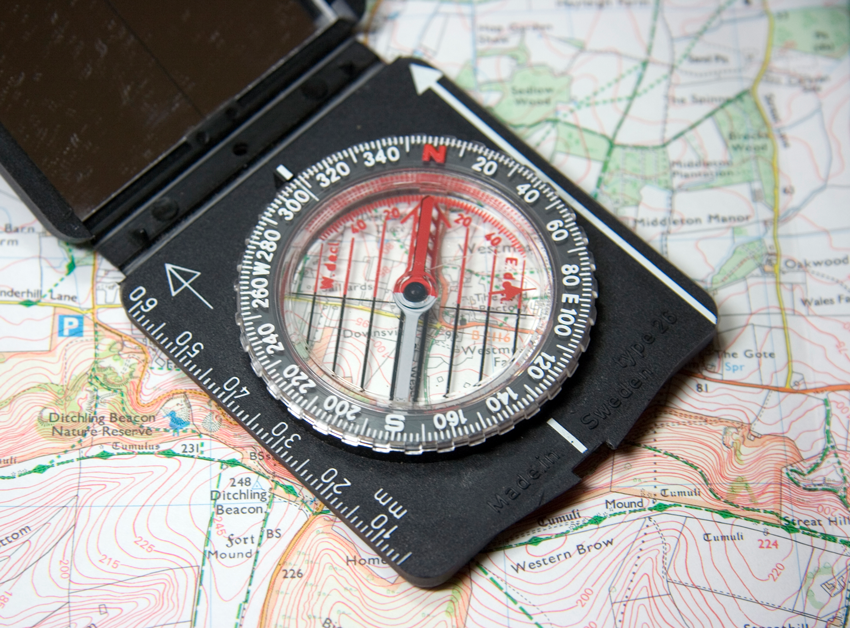
With technology getting better and the proliferation of a GPS in almost every car, thanks to smart phones, when was the last time you brushed up on your skills of reading a road map or a road atlas?
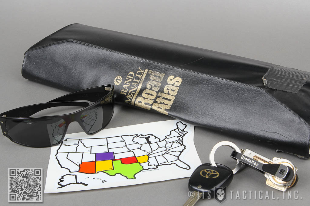
I always carry a current version of the popular Rand McNally Road Atlas in my vehicle and like to consider it a backup to my iPhone’s Navigation. With nothing more than a mile marker and general knowledge of where I am, I can navigate to just about anywhere in the United States via roads and highways. Not only that, but give you the approximate distance in mileage between where I’m currently at and the next town ahead. All thanks to the indispensable Road Atlas.
I’ll also mention that reading a Road Atlas can be a perishable skill in some situations, if you don’t review some of the finer details as often as you should. In this article, I’ll describe these finer details and walk through how to use a Road Atlas to navigate without electronics (other than those that keep your car running.)
Hitting the Open Road
A Road Atlas is nothing more than a well put together collection of road maps from all over a given area, such as the United States in general. Knowing how to properly read a Road Atlas can be an empowering tool for giving you the confidence to travel anywhere, without the need for other transportation methods like an airplane or a train.
There are a lot of benefits to traversing the country with your vehicle, such as always having a way out and being completely independent. By that I mean not having to worry if a plane is delayed or flights get cancelled, not to mention the lack of pat downs required to reach your destination. You’ll obviously still be at the mercy of your vehicle and how well you’ve maintained it, but you have to do that anyway, right?
It will more than likely take you longer to reach your destination via auto, but it’s a great way to see the countryside and get off the beaten path a bit. If you’ve driven cross-country for travel, consider taking the smaller roads and seeing new sights. We’re all so busy these days that it may be just what you need. I for one love driving through smaller towns and learning the history.
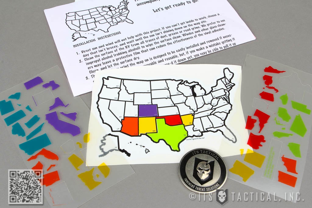
I’ve also recently picked up a neat Travel Map Sticker that allows me to add a new individual state stickers for each one I travel to on my FJ Cruiser. They come in many different sizes, all the way up to 13″ x 20″. I purchased the small 4″ x 6″ and really love the size. You have to apply the included state stickers with a razor blade since they’re so small, but I don’t mind a bit. The Travel Map Sticker is a fun way to log where you’ve been.
Dissecting the Road Atlas
A Road Atlas is easy to read, but can be overwhelming if you don’t take the time to learn the Map Legend and how to figure out distance. The first thing I’d like to go over is how a Road Atlas is organized. While these tips should apply universally to any Road Atlas, I’ll be mentioning a few things that are proprietary to the Rand McNally Road Atlas. As an aside, 2014 marks the 90th year that the Rand McNally Road Atlas has been in publication. You can already pick up the 2014 edition too.
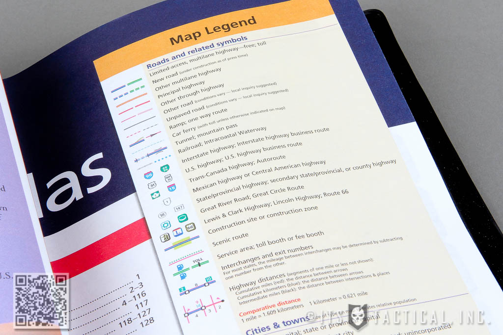
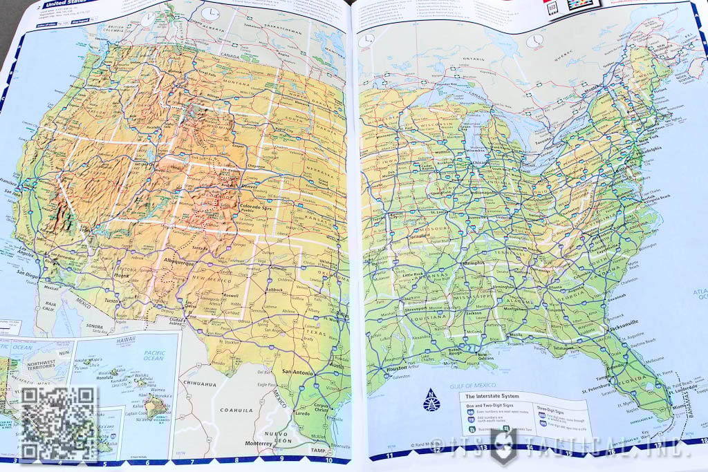
The front of the Road Atlas will give you the all important Map Legend, as well as a contents list with corresponding page numbers and a quick map references guide. These simply give you a quick reference for the page numbers that contain a specific state you’re wanting to view. The atlas is organized alphabetically by state, with some massive states like Texas taking up about six pages. Cross-country travel can find your navigator turning the atlas multiple times as you switch states during your drive.
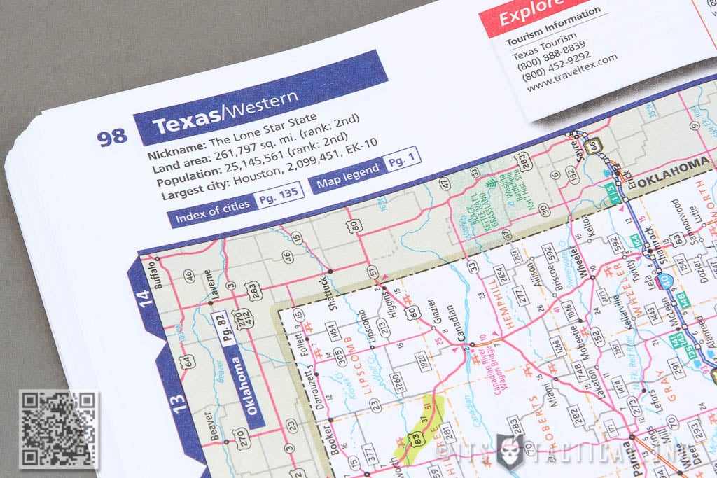
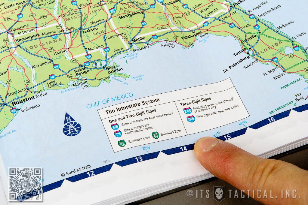
Our Interstate System is interesting and a Road Atlas is where I first learned what all those numbers and different sign shapes mean. The first split is between One and Two-Digit Signs versus Three-Digit Signs. One and Two-Digit Signs signify East/West Routes (even numbers) and North/South Routes (odd numbers.) Three Digit Signs are routes through or around a city (first digit even) or a spur into a city (first digit odd.)
Distance
Next to knowing your legend and highways, distances is the next big thing that can help you out immensely. Hopefully you’ve driven enough to know what mile markers are, but their value is truly in providing you number to reference on your Road Atlas to pinpoint your location. Assuming you know what highway you’re on, that is. Mile markers increase moving West to East and South to North.
For example, driving into Texas from New Mexico on Interstate 40, you’ll catch a glimpse of Mile Marker 374 right before you hit the border of Texas and see the number 1. It will grow in size as well before you hit Mile Marker 177 as you cross into Oklahoma. The way you can find out how many miles of highway run through a state, is with a quick look up to the top of a given state’s page for “Total Mileage Through” on a particular Interstate. Another tip is that Exit Numbers and Interchanges also correspond with Mile Markers. So exit 353 would also be Mile Marker 353 (in most cases.) Exits can be tricky in big cities, where Exit 40 can have an Exit 40a, 40b and so on.
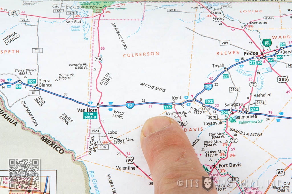
There are two sets of numbers on the photo above that correspond to distance (not counting the green boxes that are exit numbers) The black number shown is the distance between exits or interchanges, designated by the small black hollow square in the towns of Van Horn to the West on Interstate 10 and Kent to the East. 37 is the mileage between these two towns. The red number 47, just below the black number 37, is the distance between the closest red arrows. You can see one to the West in Van Horn and one to the East of Kent. We also know by the solid blue building icons near Van Horn, that we’ll be able to find a restroom at the rest area. To the East near Kent, there’s a rest stop, but no restrooms because of the hollow blue building icon.
By adding multiple black or multiple red numbers (don’t cross the colors or the streams,) you can calculate a distance between larger spans of highway. It’s also possible to calculate distance between numbered exits by subtracting them. In all it’s fairly simple to read a Road Atlas and inexpensive (about $10-12) to carry one in your vehicle as a backup. The power comes from knowing the Legend and being able to identify exactly what it is you’re looking at on the map. A small calculator can also help, just in case you’re math gets a little fuzzy on the open road.
See you out there!


Discussion